Why Is Walkerton in St. Joseph County?
The county's lines saw plenty of changes, but Walkerton's been part of it the whole time.
BY AARON HELMAN // POSTED SEPTEMBER 13, 2026
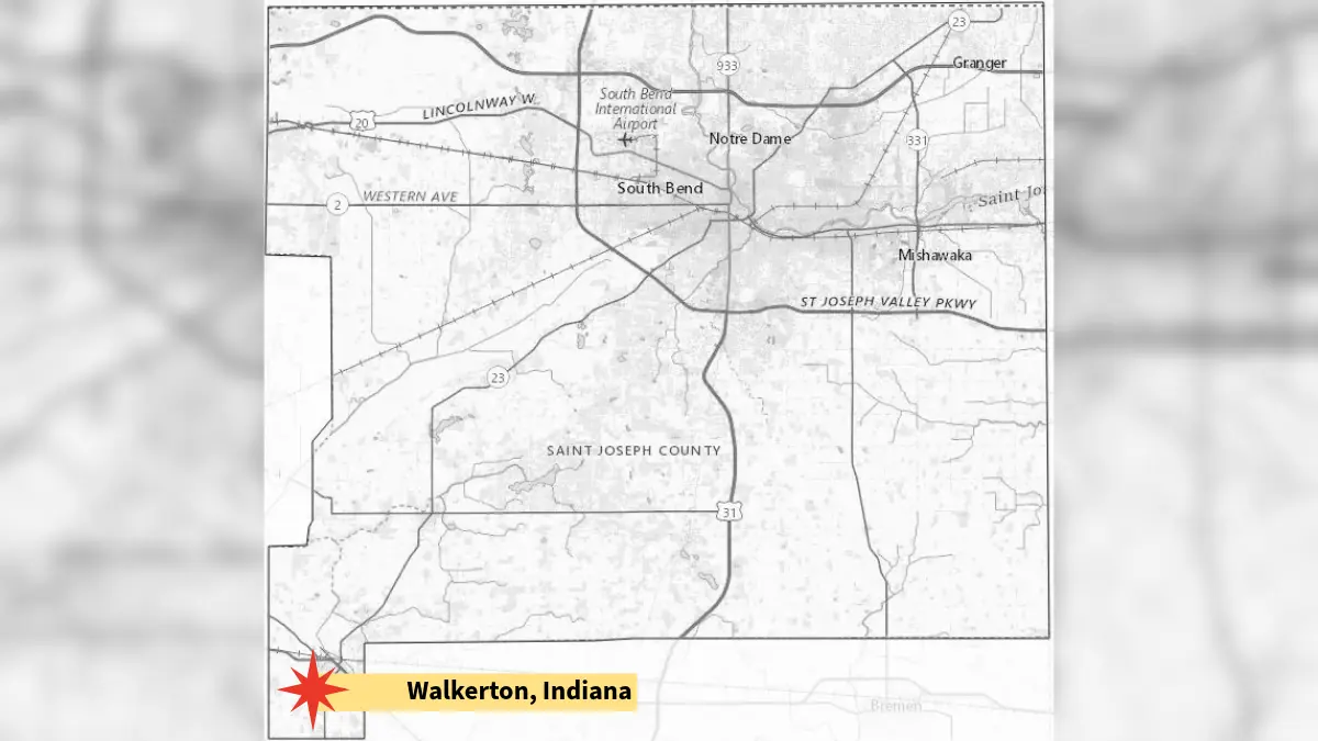
The map of St. Joseph County is mostly a rectangle.
There's a straight line running even with to the state line in the north. Another straight line that marks the place where Elkhart County begins. A mostly straight line to the west, albeit one with a strange chunk cut out of it.
And then there's the southern border, another long straight line, interrupted at the very last moment when you hit the town of Walkerton, dangling from the county map like an untied shoelace.
It's not that Walkerton feels like a mistake, but it doesn't take more than a few seconds looking at the map to see that its placement does. Walkerton is nearer to three other county seats than it is to South Bend, and it sits in a part of a map that feels like it belongs anywhere other than St. Joseph County.
But appearances can be deceiving, because, historically anyway, Walkerton is exactly where it's supposed to be.
A subscription to the News-Times is always free.
Enter your email address and get new issues straight to your inbox.
The county map did not begin with a dangly bit to the southwest. When the county was laid out in 1831, it was a rectangle, and a perfect one, just not located exactly where it is today.
The original St. Joseph County was shifted three miles further west, eating into parts of modern-day LaPorte County and giving up parts to modern-day Elkhart County. That map included the land that would become Walkerton. It did not include much of the land that would become Granger and Osceola.
But that changed pretty quickly.
When LaPorte County was organized, they petitioned for the western three miles of St. Joseph County to be added to their own, and St. Joseph County gave it to them. It was almost enough of a land grab to count the future Walkerton, but not quite enough.
Out three miles to the west, St. Joseph County moved to scoop up three miles to the east, claiming the wet and swampy parts of Elkhart County that Elkhart didn't actually want.
By the time the dust settled, St. Joseph County was still a perfect rectangle, just a different rectangle than the one they started with.
Walkerton would have been a part of both rectangles, but Walkerton didn't exist yet.
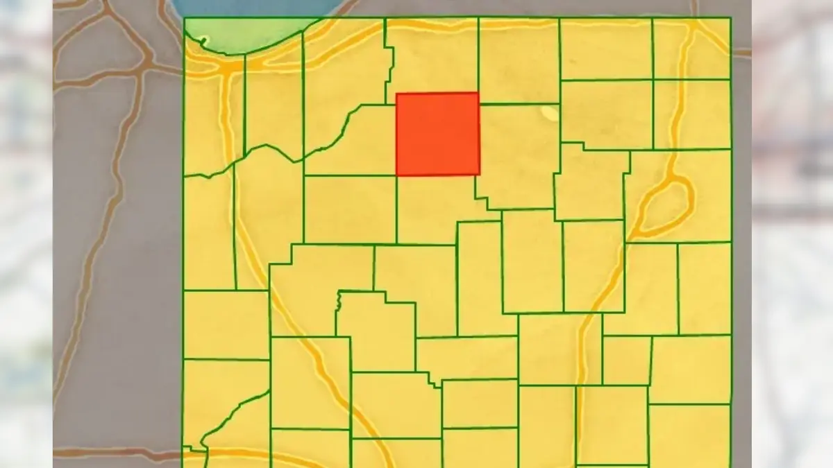
The next domino fell in 1836. That's when Marshall County was formed with an eastern border that lined up neatly with the eastern edge of St. Joseph County and a western border that didn't. There's not a great explanation for the discrepancy, but there's not no explanation either.
The people of Marshall County wanted to make Plymouth their county seat, and by drawing the lines the way they did, that put Plymouth in the geographic center of the county. It sounds ridiculous. It's also the best explanation we've got for why a lot of northern Indiana counties took on the shapes that they did.
It also meant that when Marshall County petitioned for an extra three miles of northern border, they were able to scoop up a good chunk of the southern boundary of St. Joseph County, but not quite all of it and not quite Walkerton.

The people of Walkerton didn't love being a part of St. Joseph County in those early years. It was bad enough that the courthouse in South Bend was so far away. It was worse that there was an impassable swamp called the Grand Kankakee Marsh that was between them and the place where county governance happened.
There were arguments made that Walkerton should be allowed to annex itself to Starke or Marshall Counties. (The same swamp that sat between them and South Bend also sat between them and LaPorte, so LaPorte was never really an option.) There were also discussions about forming a new county from parts of four other counties and making Walkerton the seat.
The people of Walkerton had a good argument for their position, and there was already precedent. That small chunk that had been taken from the western border of St. Joseph County was annexed to LaPorte County because the people who lived there complained that it was impossible to cross the marsh to get to South Bend.
But that was a few farmers, and by the 1850s, Walkerton was a railroad town that promised commerce and growth. They'd already given up plenty of their borders. They weren't about to lose Walkerton, and for the next 170 years, they haven't.
During the next several decades, the swamp would be drained. Railroads and then streets would connect the town to South Bend. Maybe it was still a bit of a hassle to get from Walkerton to South Bend, but certainly not more of a hassle than it would be for a town to annex itself to a new county against the wishes of the place that has a historic argument to keep it.
Why is Walkerton a part of St. Joseph County?
Because it always has been, and when everyone else came to grab at chunks of the county map, none of them ever quite grabbed at Walkerton.